blending an assortment of thoughts and experiences for my friends, relations and kindred spirit

blending an assortment of thoughts and experiences for my friends, relations and kindred spirit
By Alison Hobbs, blending a mixture of thoughts and experiences for friends, relations and kindred spirits.

Sunday, August 19, 2012

Wednesday, into Quebec

August 8th

Lifting off from Charlo we struck out across the Baie des Chaleurs, IFR but in good visibility, climbing to cross the hills on the Quebec side and eventually "maintaining 6000" feet ASL, which gave us a good vantage point for spotting the towering cumulus ahead. Even in the morning the bigger clouds appeared to be building quite rapidly above the Gaspésie once we had left the coast. We requested a detour around one cloud before returning on course which took us straight towards another, that we penetrated. We reckoned it was towering to 20,000' at most, not really dangerous yet; despite definite turbulence as we entered and left the cloud it didn't seem too drastic in the middle, just very wet––heavy rain washed our windscreen clean; it needed that. Beyond this encounter with "active weather" we could see our way to the coast, i.e. the Gulf of St. Lawrence.

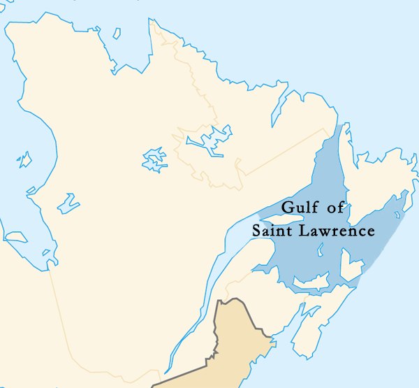
A twin-prop Navajo ahead of us cancelled IFR to allow us to do a long RNAV approach over the water, partly covered in a thin low layer of mist, to Mont Joli (CYYY). We know this airport but hadn't approached it like this before, flying a 12 mile final quite low over the sea! This airport is much livelier than the one at Charlo, advertising chartered flights to the Ile d'Anticosti: rich people fly there, willing to pay $4000 for their hunting and fishing experience. Another vehicle that stops at Mt. Joli airport is the courtesy shuttle bus from the Motel Gaspésiana by the shore at Ste. Flavie down the hill. This institution takes pride in the service it provides, so we were willing to order our lunch at their restaurant with its view of the rocky beach (tide out). The tables were stylishly laid, the waitresses looked smart in their navy blue uniforms and freshly caught cod was on the menu.

Before going back up the hill to our 'plane we decided to take a walk along the road (Rte 132) to see Le Grand Rassemblement again, Marcel Gagnon's concrete figures emerging from the sea and clustering together by his house, the Centre d'Art that I've mentioned before in this blog, where we stayed in 2009. There they were again, none of them submerged because of the low tide and some with seaweed for hair, this year. There were extra ones on tethered rafts, and when we turned away and returned up the road to the airport we passed another Gagnon creation, a flock of concrete sheep with their shepherd on the grassy slope by the Mont Joli Motel.

This time round we chose not to stay in Ste. Flavie but to fly on to Rimouski, taking the precaution of booking a room at the Comfort Inn before setting off. It was the high season. We feared we'd be too far from the centre, around the Institut Maritime, but we found we could walk there in less than an hour, along the Promenade de la Mer. Rimouski is a cultured town and a chamber music festival was going on in the area: the Concerts aux Iles du Bic, now in its 11th season. If we'd known about this beforehand we might have planned our summer trip differently! Unfortunately most of the concerts were happening in country churches at some distance, e.g. in St.-Fabien-sur-mer. The Bic islands are in an area of outstanding natural beauty, but we'd have needed more time and preparation to get there and back from Rimouski ... or perhaps not! I have just discovered from the website that a festi-bus shuttle could have served our purpose: how frustrating to find that out too late. Anyhow, we did catch part of a free, outdoor concert that was taking place in the central gardens of Rimouski's Place Publique, hearing two young performers, David Stylenko, on saxophone and Olivier Tremblay-Noël, on the marimba. I haven't been able to discover who composed their duet for "anche et baguettes" (reed and sticks) but it was French-style music of very good quality. Lots of people were sitting on the grass listening carefully.

We had a panini at Tim Horton's, a walk down the Boulevard where the shops are, including a good French bookshop that stays open 12 hours a day in the summer season, and wandered back to the Promenade just before high tide. If you scroll down to the bottom of this page (or read the French version) you'll find some information about the Tide Tower. We climbed onto the lookout to see the view and while we were up there heard the signal announcing the turn of the tide––la pause entre le flot et le jusant. An elderly gentleman sitting on the bench up there told me that, and kept talking to me when not reading his book (marking it with a pencil from time to time). He comes up to sit there every evening. He said he was born in Rimouski but had left the town for 43 years until he came back six years ago. He had missed the sunsets.

The spy in your midst

You never know who's listening; it may be one of us.

Yesterday evening we were at a very nice dinner party with friends and, as usual, when the wine glasses had been topped up, stories began to be told. In the middle of the night I woke up realising what the connecting theme had been.

Our host and hostess told us about their experience at a séance with a ouija board on a three-legged table that wobbled convincingly (!) and Chris came out with his story about participating incognito in a spiritualist meeting, once, in Welwyn Garden City. He'd volunteered to report back to the Quakers, whose premises the spiritualists were using, coming to the conclusion that the practice was mostly harmless nonsense, best left ignored.

G's story was of the occasion when he had offered to infiltrate a meeting of one of the religious groups opposed to the Gay Pride movement, to find out what their tactics were. This was shortly before the vote in the Canadian parliament that passed the law allowing same-sex marriages. He said that the viciousness of the opinions voiced hurt and shocked him, but his emotions didn't prevent him from taking notes; in fact the avidity of his note taking was favourably commented upon. "If you only knew!" he was thinking. At the end, so as not to give himself away, he had to join a prayer circle on Parliament Hill, arms entwined with the people who sought to stamp out his way of life. He still shudders to think of that.

M has just come home from a trip to Saudi Arabia to visit her family who recently moved there from Syria. She wore the obligatory veils and was glared at for allowing some of her hair to show. On flights to Riyadh the ladies on the 'plane take over the lavatories for the last hour of the flight, changing out of their western into their Arabic clothes, although underneath the robes they wear skimpy shorts and T-shirts. It is so hot (50º) and dusty in that city that you simply cannot go outside. Even indoors, if you want to keep the house clean, you have to do the dusting twice a day, and everyone's eyes are red. You can't see out of the windows because they are small and high in the walls of rooms. M coped with the climate and with the rules for Ramadan by sleeping during the day till 4 p.m. and staying up all night, but soon felt terribly claustrophobic. She took a trip to Mecca and saw the Kaaba: she hadn't expected the holy site to be surrounded by towering modern hotels. She is glad to be back in Ottawa, where she can be herself again.

All of these spy stories "speak" to me. I've often felt like a close observer myself, both at home and abroad, only pretending to belong, and am often taking notes.

Saturday, August 18, 2012

Tuesday, to the Baie des Chaleurs

August 7th

Belle Isle Bay (near Saint John) from above
On a bright, clear day we were able to take off north to Charlo airport across the wilds of New Brunswick, a 1 hour 50 minute flight north up the St. John River to the Gagetown area, then further north, crossing a hundred miles of forest. There wasn't much to look out for on the map. We crossed several rivers, such as the Southwest Miramichi, the Little Southwest Miramichi, the Northwest Miramichi (those names telling a story of confusion among the early explorers?) and the Nipisiguit River, where it became more hilly below us, sighting Bathurst Bay to the east. Then came the Tetagouche and the Jacquet River and our first sight of the Baie des Chaleurs / Chaleur Bay ahead, widening out from the mouth of the River Restigouche. This area is full of pack ice in winter, so the map informs me, so "chaleurs" may be an exaggeration.

On landing at Charlo we taxied up to the fuel pumps next to a much larger aircraft, a Hercules:


Wild and hilly scenery in northern New Brunswick
The airport was manned by one man; it used to have commercial flights landing here, but now it has been closed to commercial operations and looks as if it belonged to a ghost town, full of empty chairs and abandoned car rental desks. The citizens of Charlo and Dalhousie feel bitter about this neglect: "It's political!" we were told.

There's a Best Western hotel at Dalhousie, the grandly named Manoir d'Adelaide (a black and white portrait of the lady, a severe Victorian matron, hung in its lobby) where we got a room, not so swish as our accommodation at the Saint John Hilton. Adelaide's rooms and corridors, 22 years old, smelled of wet carpet and a corner of our room was still very damp underfoot. We wondered why the carpets had needed cleaning until we noticed a sign outside the hotel––Congratulations Linda and André––that explained it.

Causeway over Eel River
The bi-lingual Restigouche area is sadly run down, as we heard from our taxi driver and the Wikipedia article about Dalhousie reinforces that story:
Following the closure of the pulp and paper mill in 2008, Pioneer Chemicals closed a processing plant on the western edge of the town. As a result of the closures of these industries, the New Brunswick East Coast Railway and its subsequent owner CN Rail announced that it was declaring the railway spur into the town surplus. [...] The town's only remaining industry is the Dalhousie Generating Station, a thermal power plant operated by NB Power, which is in the process of being decommissioned. While there are several smaller employers, the largest employer in the town at the current time is the Dalhousie Nursing Home.
The fishing industry has gone too (at Tim Horton's, I overheard a local man complaining about the fishing restrictions) and the paper mill has been demolished, obliterated, leaving a wasteland on the shore. This piece of land could be turned into something spectacular, given the natural beauty of the area, but the question is, can enough money be made available? "What can we offer tourists? the Dalhousie council must be wondering, although the long distance buses and ViaRail trains no longer stop here. According to the leaflets we saw, the Eel River Micmac reservation has some new tourist outlets, you can go duck-spotting on the marsh by the causeway or you can book a guided tour of the church graveyard, starting at 10 p.m.

The cash register on display at the Dalhousie museum
Strolling around the town, we found the Provincial Court and a regional museum. The young gentleman who welcomed us to the museum was extremely attentive to us (maybe his only visitors that day) walking round with us and telling us what every exhibit was. They had smoothing irons, wringers and very old washing machines upstairs and a glamorous cash register among the historic artefacts downstairs. There isn't a lot of history in these parts, with nothing to display between the prehistoric giant scorpions and the 19th century lumber trade.

From there we walked in the sun to the RV campground by the beach with its lighthouse and view of rocky, bird covered islands (the Bonamy Rocks) near the shore and beyond them the great bay and the distant hills of the Gaspésie on its other side. If only they could "sell" this spectacular scenery to more visitors and if only the tourist season lasted more than six weeks a year, the people of northern New Brunswick might stand a chance of economic recovery, but two-thirds of Dalhousie's population have moved away, including most of the younger generations; its most thriving business at present is a rest home for seniors.

After supper we went for a walk to the dock near our hotel and met a woman on a fishing boat clearing up a mess in rubber gloves. Some youths had trashed her boat "... and the police are useless," she told us. The dock smelled of shellfish, taking me back to my youth on the Yorkshire coast. Beside a flock of resting seagulls, we sat on a piece of driftwood on a beach choked with old sawdust and watched the sun go down.

Tuesday, August 14, 2012

Monday, along the St. John River

August 6th

Cable ferry, Westfield Point
"Uptown" at Saint John, during our breakfast at Cora's again, not very early in the morning, we watched the low cloud begin to lift, but had already booked a third night at the Hilton (at the special holiday weekend rate of $119 per night this was too good an opportunity to miss) and decided to drive around in the rental car for the rest of the day, exploring the lower reaches of the St. John River. Come to think of it, I ought to link this post to my River Diary blog.

As soon as we left the coast road out of town the sky above us was clear and blue: no sea mist beyond the immediate vicinity of the shore, and it was turning out to be much finer than forecast. Our first stop was at Westfield Point at a ferry station at the lower end of a wide stretch of river called Long Reach. The two ferry boats in operation here were operated by cables, a local invention from the 1900s. Its reliability is not perfect*, but in normal weather conditions it works fine. Originally, horses used to haul the cable around the drum, but now it's fully automatic.

* That accident report contains some very interesting information about the Westfield ferry, by the way.

Scenery seen from one of the ferries
Around the tourist information building in the car park, from which country music was being broadcast ––"...drifting too far from the shore ..." on fiddle and mandolin, for instance––several historic plaques told the story of this area. French (Acadian) settlers and British Loyalists had settled here, with co-operation from the native population. When the Loyalists arrived after the American War of Independence (ca. 1784) each family was granted an urban plot at Saint John plus a larger plot up-river. We drove through several of these little communities, hardly any of which had shops, lodgings or places where you could buy food, up the west side of Long Reach as far as Nerepis Marsh, the name meaning "place where the eating is good," presumably a reference to the ducks and fish that still live there.

The old church at Kingston
From the marsh, not finding any other ferry in the vicinity of Hampstead (as marked on my obsolete road map of the maritime provinces) and unwilling to drive as far as the bridge beyond Gagetown on this occasion, we did a U-turn and backtracked to the ferry we'd spotted at Evandale. I'd also spotted some parasols there that hinted at a place for lunch between our road and the river––the Evandale Resort, a riverside inn with mooring facilities for motorboats. After eating there we drove onto the ferry, crossing onto a sizeable peninsula between Long Reach and Belle Isle Bay, an inlet of the St. John. We got onto the wrong road, raising a cloud of dust, and had to turn around again. Someone was tending a magnificent vegetable plot on the hillside. Crossing the water on the longest of the cable ferries at Long Point where a spit of sand pointed into the lake we carried on to a place called Kingston––Westfield ... Hampstead ... Kingston: it sounds like a tour of greater London––where we came upon the oldest surviving Anglican church in New Brunswick, Trinity Church, clad in white clapboard siding. We parked for a pause at the General Store which is about as old as the church (1788), selling Irving Oil (as does every other roadside halt in NB), then drove down another country road back around many curves to the Westfield ferry again.

Sand Cove beach
Time to return to the hotel now, we thought, but we took a wrong turn for the third time and ended up at Sand Cove instead, near the Irving Nature Park where you can hammer at the rocks in search of fossils. The part of the beach we walked along had sandy cliffs eroded by rain; in the distance we could see a container ship anchored out at sea.

After another supper at A Taste of Egypt we walked further through the atmospheric streets of old Saint John, through a rough area with pawn shops and liquor stores. In a park square stood a lonely statue of Samuel de Champlain (who named the Rivière St. Jean) that clearly didn't fit with the statues of Thomas Carleton and Sir Samuel Tilley in King's Square further uphill.

People apart, coming together (detail) by Hooper
The former docklands were being gentrified, it seemed, with new waterfront condos for sale and souvenir shops for cruise passengers. There used to be an imposing customs house in this part of town, a fine piece of architecture to judge from the old photos; it had been torn down in the 1960's to be replaced by concrete blocks with no curves to them; what a shame. However, more recent buildings have given the city quite a stylish, modern look, and the realistic sculptures of townsfolk by John Hooper, such as the group of People Waiting outside Barbour's General Store, are great fun.

People Waiting, by John Hooper (plus me)

Sunday, August 12, 2012

Tracking our flights

We are home from our flying holiday–– I'll add some pictures to the story I began to tell in my previous two blogposts and there'll be more posts to follow. In the meantime here is proof of the fact that nowadays all the IFR flights logged by Chris flying C-FPTN (Canadian Foxtrot Papa Tango November) are officially tracked. This is an image cut from the FlightAware website:


The blue dashed line shows the last leg of our flight home from Trois Rivières to Gatineau yesterday afternoon, as filed. The slightly wobbly white line, that more or less follows the blue dashes, is the route we actually took. We didn't reach Gatineau airport itself, because for the last 15 minutes we could see the heavy rain cloud ahead (the smaller radar blob on the left). We cancelled our IFR approach and diverted to our home airport, Rockcliffe, instead, where we landed after the shower had gone by. (We were in and out of some developing cloud during the turns, but these don't show up on the picture.) If you click on the picture and then look carefully you can even see the little circuit we did before landing at Rockcliffe.

The much bigger cell of bad weather to the southwest of our track was a thunderstorm of some magnitude whose flashes were showing up on our StrikeFinder.

In case you wondered, the other white lines are the divisions between Ottawa and Montreal airspace and between neighbouring areas of the sky controlled by flight services in the USA. The rather vague start to the line of route from CYRQ (Trois Rivières airport) was due to the fact that, after taking off towards the east (because of the wind direction and the need to avoid a high tower), we had to climb to a certain altitude before being detected by the flight tracking radar; it therefore looks as if we began our flight east of that airport.

Sunday, August 5, 2012

Mist along the cliffs

Tonight we have 8 octas of fog, visibility at the airport an eighth of a mile, vertical vis. 100 feet, temperature 20, dewpoint 20, which means that we cannot see a thing from our bedroom window on the 11th floor of the Hilton except by looking straight down; the lighthouse on the dockside adjacent is slightly visible. It reminds Chris of the Fens (of his youth).

Till late afternoon today the sky was blue and cloudless. We ate our breakfast at a Cora's restaurant with toast, eggs and fruit galore. Orange juice and no coffee for me. Then we took the car up the road to Loch Lomond, the lake just past the airport, and beyond. Road 111 leads to St. Martin's, a fishing village at the mouth of the Irish River where the tides rise and fall by as much as 27 feet. We had a long stop there sitting by the harbour, buying icecream. Nothing else for lunch because too many other tourists were parked by the restaurants near the rust-coloured sea caves round the corner, so we carried on up to the Fundy Trail Parkway entrance, 7km further along the cliffs.

The Flowerpot Rock
It cost us $4.50 apiece to enter the park, warmly welcomed by uniformed park wardens. Once in, we stopped at several of the lookouts along the parkway to see the views of the shoreline. At the first one we wandered off for a hour's easy walk on the grassy "Flowerpot Trail" punctuated with lookouts like the road above. The Flowerpot is a thin, tall rock in the bay, eroded at its base by tides and topped with fir trees, very photogenic, as was the Fuller Falls, a delicate waterfall we saw later on, where crowds of people, mostly friendly Chinese families from Philadelphia, were climbing down the ladder steps to the viewing platform, with cables for railings.

The midpoint of our visit to the Fundy Trail was at the mouth of the Big Salmon River where we sat on the beach chewing energy bars before tackling the wooden stairway to the Interpretive Centre on the site of a former saw mill. The old wharf that belonged to it is dimly visible like an underwater ghost in the stony river below.

We drove a couple of miles further along the winding road to a high point (Chris rather anxious about our gears) from which we could see a roll of sea mist forming; it seeped its way in and up through the treetops, coming and going in wisps, mysterious and beautiful.

The parkway and pathways are well labelled with plaques that describe various species of flora and fauna, including ospreys and kingfishers. No sighting of those today, but I did sample the wild raspberries and found cloudberries, too. We drove back to the city along a very lonely back road with the mist, fog rather, now settling in for the night and giving us increasingly blurry views of the mudflats, crossed by covered and uncovered bridges, and endless conifers.

Damp in the cloud and very hungry we relished our supper at A Taste of Egypt up the hill on Union Street. The room was decorated by sphinx and mummy replicas and rows of shisha pipes: chickpea soup with lime juice in it for me followed by Nefertiti's Touch (this was skewered chicken on clove-flavoured rice) with hibiscus tea. Afterwards we looked at the monuments in King's Park (the King being Edward VII--there's a fountain playing in his honour). Saint John was established in 1784, as a Loyalist settlement. We saw one of the original Loyalist houses built on top of a floor of rock.

Saturday, August 4, 2012

Down east

Today we flew to New Brunswick, not thinking of the change of time zone until after 8 in the evening when we suddenly realised it was getting late, here.

"PTN departing from Rockcliffe straight out to the east," announced Chris on the airwaves, as we took off with a squawk code from Gatineau Flight Services. Our IFR flight plan was cleared as filed: maintain 5000', direct Lafit, Rabik, CYSC. CYSC is Sherbrooke airport where we have been before, and the waypoints were just triangles on the map, invisible on the ground. It was a hazy, hot day with no lightning strikes within a 200 mile radius. That was lucky. At St. Jean airport (not to be confused with Saint John, today's destination, we crossed the Richelieu River, packed with pleasure boats.

Shadows over the Maine-New Brunswick
border, from 9000 feet up
(our wing strut visible in bottom r h corner)
After a good lunch at the Resto de l'Aeroport at Sherbrooke, we were sent up to 9000'-- it took us half an hour to climb to that altitude and we stayed there, skimming through the tops of the fluffy cumulus clouds for another hour and a half, on the Victor 300 airway towards Millinocket and, before we got there, onto a direct course for another invisible waypoint called MOWND, thence to Saint John. Many wind turbines could be seen in the wilds, besides the usual rivers, lakes and forested steep hills. It was cool and smooth up there, but not so smooth on the descent to warmer air. We could see the estuaries of the rivers that pour into the Bay of Fundy, and Grand Manan Island on the horizon beyond St. Stephen's. It was easy to spot the Saint John airport beyond the city and its harbour, impossible to spot the fact that nobody was around to man the FBO which in fact had been closed for the long weekend since lunchtime. They won't be reopening till Tuesday! We arrived at supper time and had to make a phone call to ask where to park, how to get out of the airport, how to buy fuel before Tuesday. Supplied with answers to all these questions, after the FBO manager's wife had found her husband at home to answer the call, we managed to rent a car and drive into town, past the Irving Oil refinery and an amazing number of petrol stations by the roadside.

Evening view from our window at the Hilton, Saint John
I had booked us a room at a remarkably reasonable rate at the Hilton; what's more they upgraded us on arrival to a room with harbour view, high up and very satisfactory.

We took an evening walk around the town whose heyday was the 1880s, when a third of Britain's sailing ships were built here. The redbrick buildings look old; the hills down to the docks are steep. We sat on a bench on the boardwalk opposite a cluster of fishing boats starting to rise up the harbour wall with the incoming tide and watched a freight train go by. It had 56 carriages, mostly oil trucks.

Wednesday, August 1, 2012

"Mein Herz! Mein Herz!"

That's a line from Schubert's song, Die Post (No.13 of the Winterreise cycle). I performed it once for my A-level music exam. and now my husband sings it sometimes.
Was hat es, dass es so hoch aufspringt, mein Herz?... Was drängst du denn so wunderlich, mein Herz?
I've thought of that this week, while I've not been feeling well, suffering from a virus I must have picked up on the flight home from California, coughing a lot, and my heart pulsing like the accompaniment to that song where it modulates into the minor key (... dum-da-dum-da-dum ...) which is not its normal beat. On Sunday morning I was so alarmed by this erratic rhythm that I told Chris I thought I'd better go to a walk-in clinic to see a doctor––he promptly drove me to the Emergency Services Unit at our nearest hospital. It turned out to be an Interesting Experience, paid for by OHIP, of course, not me.

The triage nurse took a look at me (she wrote "colour, good" on the admission form), took my temperature and blood pressure and decided that I wasn't a particularly worrisome case. That was good, but it meant I had to wait my turn. Anticipated waiting time, 4-5 hours, so it said on the notice board. In a corner of the waiting room was a TV showing the beach volleyball games at the Olympics. This was a quiet day; we were lucky. Recently, so one of the hospital orderlies told me, the Emergency Unit had been so packed that at one point 40 people had been lying on gurneys in the corridors, waiting to be seen, and only two doctors on duty.

While waiting to be seen myself, I had four phials of blood taken to test my iodine, sodium, potassium levels, etc., a preliminary ECG test, and a cream cheese bagel from Tim Hortons. I thought I'd better avoid the coffee. Then a doctor took me briefly aside to go through my admission notes and tell me to wait a little longer before another doctor could examine me. After a couple of hours I was assigned a bed with privacy curtains around it (not that the curtains conceal any sounds!) where I could wear a hospital gown and be hooked up to the combined heart-, blood pressure- and oxygen-monitor. Luckily again, I'd made a point of asking whether Chris could come with me to this area, and he could––the nurse even brought him a chair, which was just as well, since we stayed there for another six hours. I'm also glad we'd both had the presence of mind to bring some books and such with us. The lady in the next bed along, also being tested for heart problems, had nothing to read (as we could hear her complain through the curtains) so in the end Chris took pity on her and gave her our copy of a recent London Review of Books; she accepted it gratefully! Other emergency patients on my row were in no fit state to read. One was groaning piteously, hardly conscious, and another was being interviewed by a psychiatrist. Quite comfortable on my raised bed with the two big pillows, except for the fact that the sensors with their cables and the sticky pads all over my skin were a bit irritating, I began to feel like a fraud for being there at all. Chris was fascinated by the machinery, though, especially as he analyses the operating systems of heart monitors, these days. This experience has brought the task to life for him!

Eventually an "intern" came to talk to us. He seemed very young but had a nice bedside manner; I'm glad they teach them that, these days. Going through the details and giving me the results of my blood tests (all clear) he gave the impression that I didn't have much to worry about, but he would return soon with his supervisor ... also young and courteous, who said much the same. The trouble was, neither of them seemed to know what was wrong with me. The intern student had drawn me a picture of the electrical pulses in my heart and the second doctor gave the abnormality a name that sounded like "By Gemini!" (Bigeminy). To Chris, it looked like bigamy. To rule out the possibility of a blood clot, heart attack or defect in the lungs, the doctor recommended I have a second blood test six hours after the previous one and a chest x-ray, which reminds me of the book I'm currently (re)reading, Thomas Mann's Der Zauberberg: in which the hero is overawed by the chest x-ray pictures he sees––new to the world in the first decade of the 20th century when that story takes place. I was quite impressed with my own lungs, too, which I could clearly see on the computer screen in the doctors' room opposite my bed. I could recognise my shoulders, even though just bones. Those extra tests also turned out to give reassuring results (clear, normal).

I was finally released from my cable attachments and sticky pads and the hospital itself at around 9:30 p.m. and we thankfully drove back home.

My heart is still skipping. In a couple of weeks I'll have a Holter monitor fitted for a 24-hour assessment and shall see a cardiologist in mid-September. We still haven't a clue what has caused the problem.